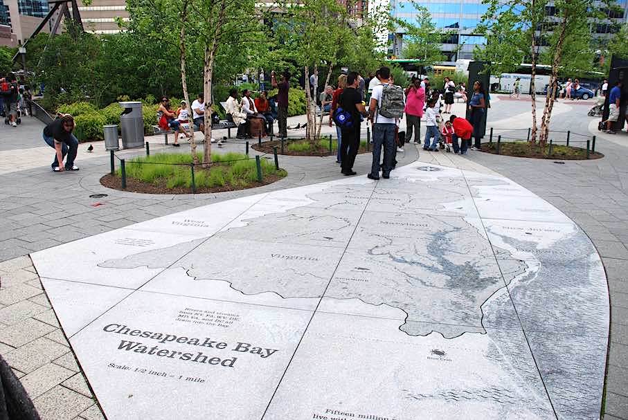
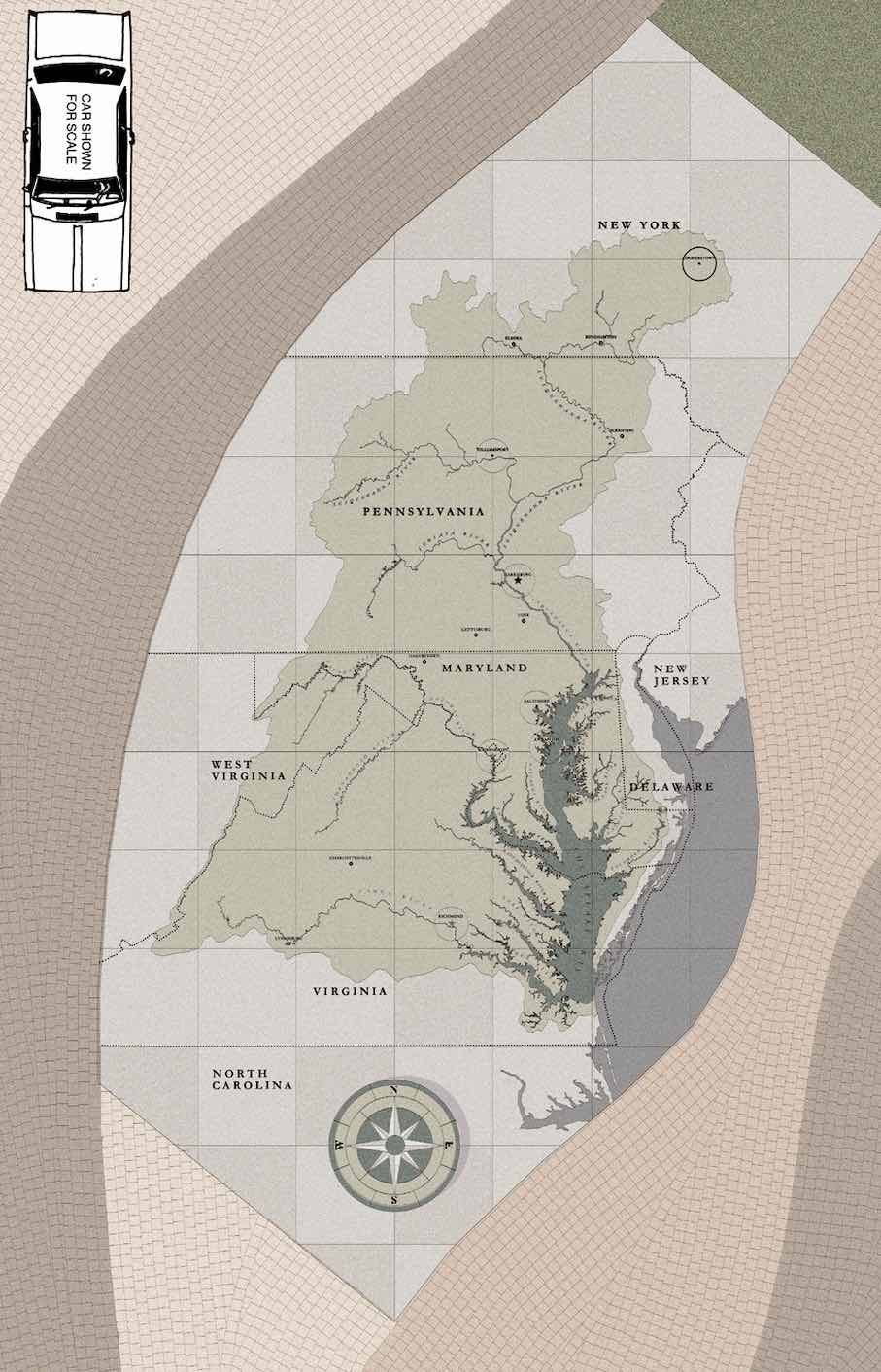
The map displayed in the forecourt of Baltimore’s National Aquarium in the US State of Maryland is a true sensation for visiting school children: not only can they obtain a bird’s-eye-view of the area. They can also cover the area in a few giant steps all the while gathering important basic knowledge of nature, particularly the circulation of water and the oceans, rivers and brooks, i.e. that the latter run together and accumulate behind the ocean’s coast.
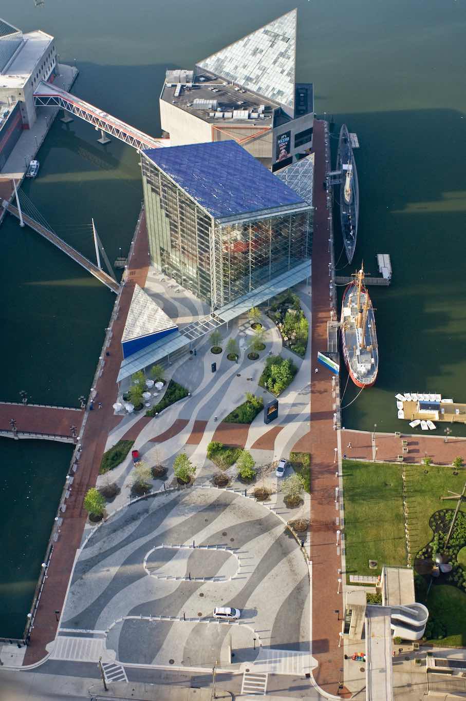
The forecourt of the museum used to be a rather sorry area. During the course of renovations, the museum’s interior was brought before the doorstep: the pavement is covered in waves and local fauna. Niches around the map on the ground allow visitors to rest while contemplating the map of Chesapeake Bay Watershed which includes the museum itself as well as the U.S. Capital, Washington D.C.
The forecourt was designed by landscape architects Rhodeside & Harwell and implemented by the Coldspring Company.
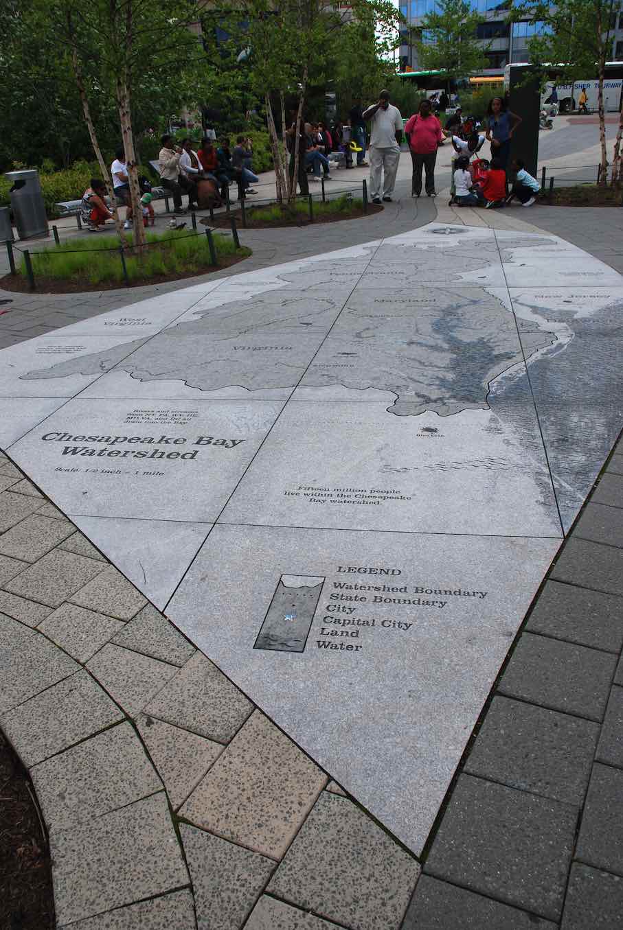
The map highlights the ocean (right) and the major waterways in blue. The watershed itself in the middle of the map is depicted in dark Mountain Green Granite from the State of New York, surrounded by lighter Irridian Granite from Minnesota. The edges of the stone are precisely cut to shape by means of water jet allowing them to fall into place like pieces of a puzzle.
The blue of the waterways and of the ocean were obtained by special technique. „Most of the lettering and graphics are sandblasted into the stone“, writes Duan Kruger from Coldspring in a mail, „the capital city and city of Baltimore are referenced with a stainless steel star or round medallion that is recessed flush and epoxied into the stone.“
The map measures 11.20 m x 7 m in total and comprises slabs of 1.35 m² x 5 cm thick. The granite was set in a mortar bed on a concrete slab with grouted joints.
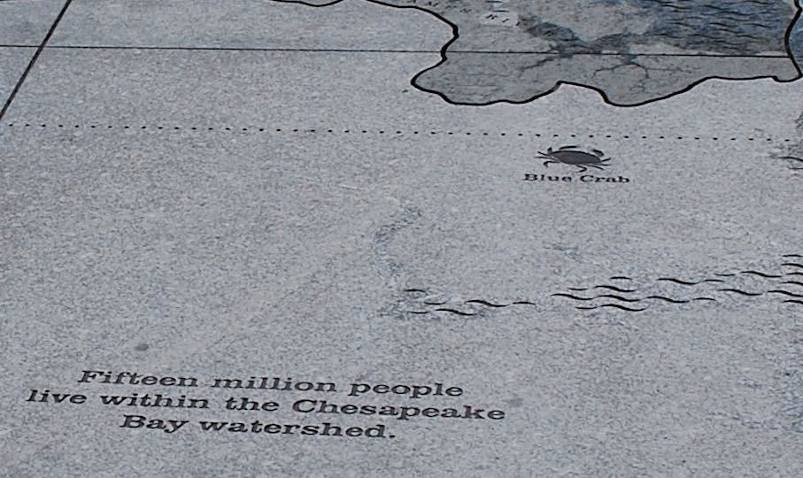
The little crayfish at the southern edge of the map symbolizes the important fishing industry situated there.
Chesapeake Bay came into being about 35 million years ago after a meteorite hit the area. Over 150 brooks and rivers gather here ending their journey from seven States and finding their way back to the ocean.
Photos: Rhodeside & Harwell