


An international team of scientists has investigated the sediments in the subduction zone and found a lack of „plasticizer“
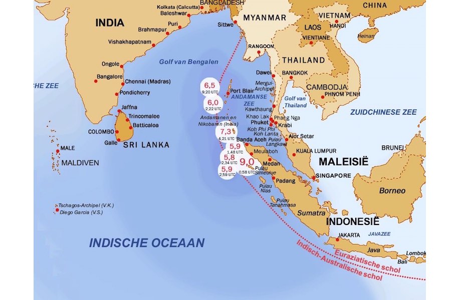
At Christmas 2004 (December 26) a terrible earthquake with a strength of 9.2 occurred in front of the Sumatra coast causing a tremendous tsunami in the Indian Ocean with more than 250,000 dead. An international team of scientists has found evidence suggesting the dehydration of minerals deep below the ocean floor influenced the severity of the quake. In figurative terms: there is a lack of „plasticizer“ in the therefore very compact sediments allowing the rupture to spread over a large area.
The scientists concentrated their research on a process of dehydration of sedimentary minerals deep below the ground, which usually occurs within the subduction zone. It is believed this dehydration process, which is influenced by the temperature and composition of the sediments, normally controls the location and extent of slip between the plates, and therefore the severity of an earthquake.
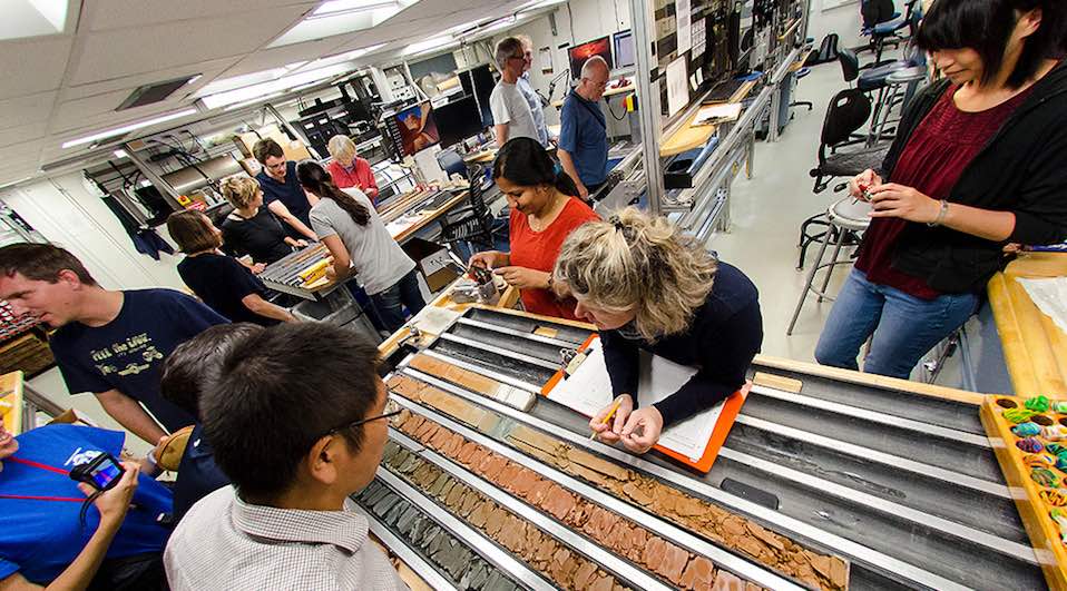
In Sumatra, the team used the latest advances in ocean drilling to extract samples from 1.5 km below the seabed. They then took measurements of sediment composition and chemical, thermal, and physical properties and ran simulations to calculate how the sediments and rock would behave once they had travelled 250 km to the east towards the subduction zone, and been buried significantly deeper, reaching higher temperatures.
A subduction zone is an area where two of the Earth’s tectonic plates converge, one sliding beneath the other, generating the largest earthquakes on Earth, many with destructive tsunamis.
The researchers found that the sediments on the ocean floor, eroded from the Himalayan mountain range and Tibetan Plateau and transported thousands of kilometers by rivers on land and in the ocean, are thick enough to reach high temperatures and to drive the dehydration process to completion before the sediments reach the subduction zone. This creates unusually compact material, allowing earthquake slip at the subduction fault surface to shallower depths and over a larger fault area – causing the exceptionally strong earthquake seen in 2004.
The findings explain the extent of the large rupture area, which was a feature of the 2004 earthquake, and suggest that other subduction zones with thick and hotter sediment and rocks, could also experience this phenomenon. Similar zones exist in the Caribbean (Lesser Antilles), off Iran and Pakistan (Makran), and off western USA and Canada (Cascadia).
Research into the earthquake was conducted during a scientific ocean drilling expedition to the region in 2016, as part of the International Ocean Discovery Program (IODP), led by scientists from the University of Southampton and Colorado School of Mines. Also a group of scientists from the MARUM-Center for Marine Environmental Sciences at University of Bremen was involved. The study is published in the journal Science.
Science 2017, DOI: 10.1126/science.aal3429
Source: MARUM
(04.06.2017, USA: 06.04.2017)